How do you protect a large natural landscape when vegetation changes, animals move and environmental pressures emerge beyond the view of patrol teams? Artificial intelligence offers a useful possibility: helping conservation staff decide where to look, what to check and when to respond. Its value depends on the decisions it supports. A growing collection of photographs or a sophisticated dashboard does not, by itself, establish that a reserve is better protected.
The conclusion of the Mahmiya forum at the University of Jeddah brings that discussion into a Saudi context. This article separates the recommendations reported in the news from our practical interpretation of how a monitoring programme could work. The operational examples below are proposals and hypothetical scenarios developed for this analysis. They should not be read as projects that the forum announced, funded or launched.
What did the Mahmiya forum recommend?
According to the Saudi Press Agency report published on October 2, 2026, the two-day forum ended the previous day. Its directions included integrated AI and spatial monitoring, habitat and biodiversity restoration, and research serving field needs. Further recommendations covered partnerships, sustainable tourism, community participation, training, One Health, governance, environmental risk management and impact measurement.
These are recommendations for action. The report does not establish that an AI system is operating across every Saudi reserve, and it does not provide a single implementation budget or nationwide completion date. Readers should therefore distinguish an agreed direction from a delivered service. The next useful questions concern specific responsibilities, realistic operating arrangements and evidence that a proposed intervention has improved conservation work.
From a wildlife photograph to a conservation decision
WWF’s overview of artificial intelligence and conservation describes using camera images and satellite information to monitor species and habitats. This international context helps explain the technology’s general potential. It does not demonstrate that a particular Saudi reserve has adopted the same tools or achieved the same results.
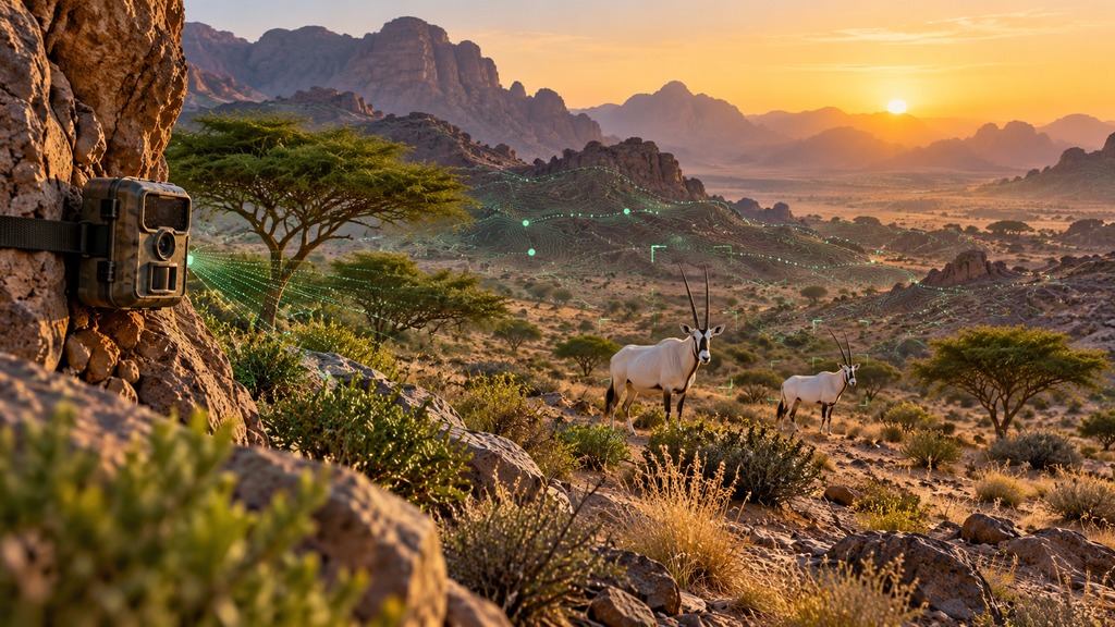
Consider a hypothetical monitoring station that produces thousands of photographs. An assisted sorting system could flag images likely to contain an animal, allowing a researcher to review a smaller, more relevant queue. Yet multiple images do not automatically represent multiple individuals. One animal may return repeatedly, and cameras positioned nearby may record the same passage. Turning observations into a population assessment requires an appropriate ecological method.
A sensible proposed workflow would preserve the original image, recording time, device location and review history. When software flags a possible rare species, a qualified reviewer should be able to confirm or correct the classification. That makes uncertainty visible and allows errors to inform improvements. A headline total displayed without its underlying method can conceal more than it explains, especially when monitoring coverage changes.
Spatial monitoring can guide a field inspection
In another illustrative scenario, reserve staff compare images of an area at different times to identify an unusual change in vegetation. A less green patch might justify closer investigation. It does not reveal the cause on its own: season, lighting, image quality and actual ground conditions all deserve consideration. The purpose of an initial alert should be to direct attention, rather than to close the investigation prematurely.
We propose a short decision chain: detect a possible change, check the input data, assign an inspection priority and record the findings from the visit. If the field team confirms a problem, specialists can select a response and document what follows. Defining that chain before choosing equipment also clarifies which technical features are necessary. A tool is easier to evaluate when its role in the work is explicit.
Habitat restoration needs evidence beyond planting day
A proposed restoration project should begin with a documented baseline. Staff would record the starting condition of the site, the pressures they intend to address and the method used for subsequent comparisons. Photographs taken immediately after rain should not casually be compared with photographs from a dry period as proof of an intervention’s success. The timing and circumstances of observations need to accompany the results.
Planting totals describe activity. Continued plant survival and an improving habitat condition come closer to describing outcomes. For an illustrative project, useful questions might concern the survival of selected plants, maintenance requirements and whether new damage appears. Appropriate targets would need to be set by specialists familiar with the particular environment. This article supplies no numerical restoration target for Saudi reserves and does not imply that one universal measure fits every site.
The same caution applies to wildlife photographs. An increase in recorded sightings may reflect more cameras, better positioning or a longer recording period. It is not automatically evidence of population growth. A monitoring report should document changes in sampling effort so that researchers and readers can understand the comparison. That small discipline can make a conservation update substantially more informative than a broad claim of success.
How could an AI programme be evaluated?
Our suggested starting point is a set of operational questions. Does an alert arrive early enough to support a response? How often does review show that it was unnecessary? Does image sorting save time while preserving important observations? Can reserve staff maintain the service when the initial demonstration ends? These questions connect technical performance to conservation practice and help identify what should be measured.
| Area | Suggested evaluation question | Context needed |
|---|---|---|
| Image classification | Does it distinguish the relevant species? | Error types and recording conditions |
| Alerts | Does it help prioritise inspections? | Review time and unnecessary alerts |
| Restoration | Does improvement continue after intervention? | Season, site and measurement method |
| Operations | Can the service remain available? | Maintenance, connectivity and staff training |
This table is an analytical framework proposed by SaudiWe, rather than an official forum scorecard. It encourages a project team to explain what changed and why that matters. Public summaries could communicate overall progress while keeping sensitive details within authorised teams. Useful transparency includes acknowledging what has not yet been measured and explaining where results are uncertain, instead of presenting accuracy as identical everywhere.
Protecting wildlife also means protecting information
When designing a monitoring service, the location of a vulnerable animal deserves careful treatment. Publishing precise coordinates merely to demonstrate the sophistication of a map could create avoidable exposure. A proposed public dashboard might show a broad area, while detailed records remain available to staff who need them. Field photographs that include people also call for clear rules governing purpose, access, retention and appropriate use.
Equipment reliability belongs in the same conversation. Who notices a depleted battery? What happens when connectivity fails? Can important records be recovered after a device breaks? These questions are less eye-catching than an announcement about an intelligent platform, but they shape whether the service can be trusted. A practical backup arrangement for field monitoring would help teams continue their work when digital equipment needs attention.
Researchers and local communities contribute different expertise
A useful proposed research partnership would begin with a question that reserve managers actually need to answer. University researchers could test a sorting method or compare monitoring approaches, while field staff contribute knowledge of access routes, seasons and recording difficulties. Agreeing on data formats, responsibilities and the way results will be handed over helps prevent a project from ending with a report that is difficult to use.
Nearby communities could also contribute observations, visitor guidance and suitable services. Effective participation requires clear instructions: what should be reported, how will a report be checked and which behaviours protect the site? Readers interested in the wider public relationship with wildlife can explore SaudiWe’s guide to the Saudi falcons and hunting exhibition. Access to a reserve should always follow that location’s own visitor requirements.
A monitoring programme needs people who collect records carefully, review them competently and understand the limits of analysis. For readers building a technical foundation, our guide to the One Million Saudis in AI initiative offers a related introduction to learning opportunities. General AI education can provide a starting point; conservation work also needs ecological knowledge and supervised practical experience.
Environmental technology should examine its own footprint
The United Nations Environment Programme discusses energy demand, water use and electronic waste associated with AI infrastructure. For a proposed conservation deployment, that suggests comparing operational requirements with the benefit sought. Teams could choose an appropriate scale of processing and storage, rather than assuming every monitoring task needs the largest available model or indefinite retention of every file.
The Mahmiya news creates an opportunity to discuss protection that is informed by evidence and sustained by follow-up. The developments worth watching next are concrete initiatives with defined objectives, responsibilities and published outcomes. Until those appear, the recommendations can be understood as a direction for future work. Each application should then be judged by its contribution to habitats, species and the people responsible for their care. The useful result is a trustworthy observation reaching the right specialist in time to support a sound decision.